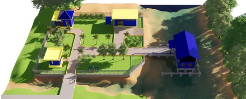
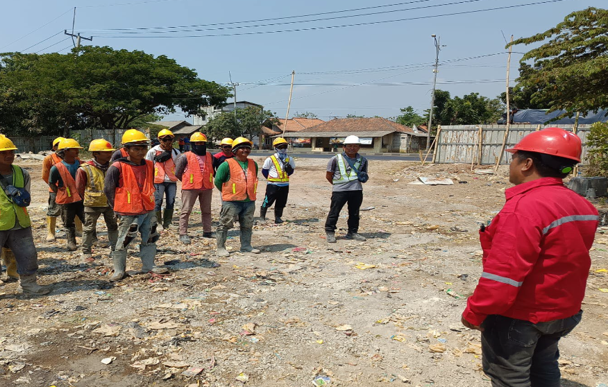
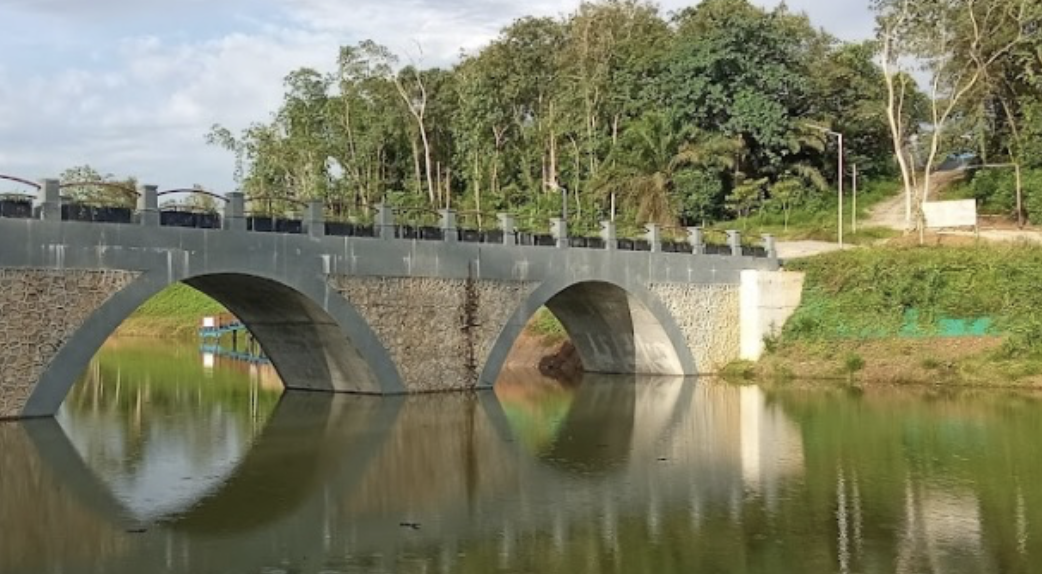
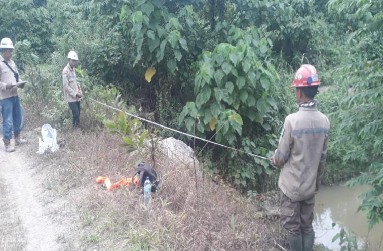
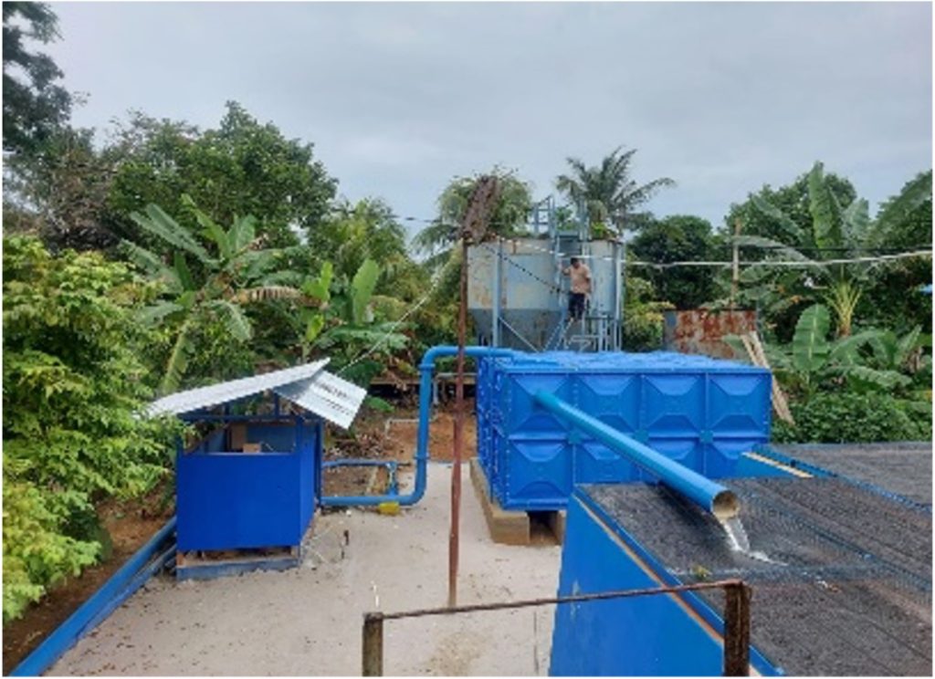
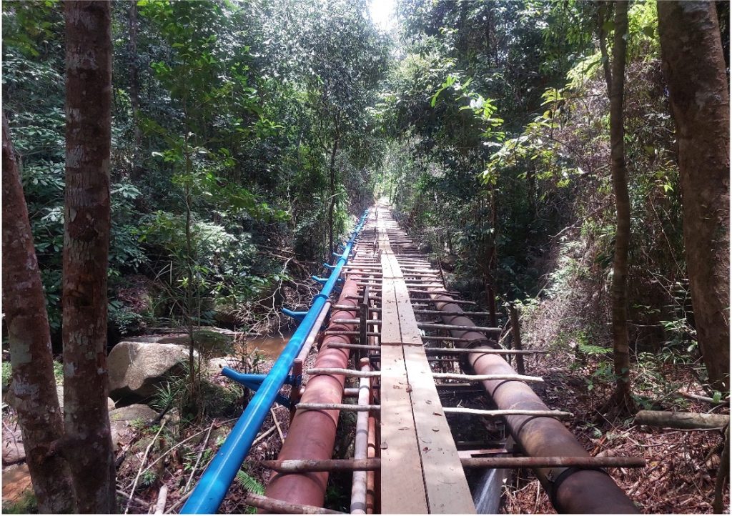
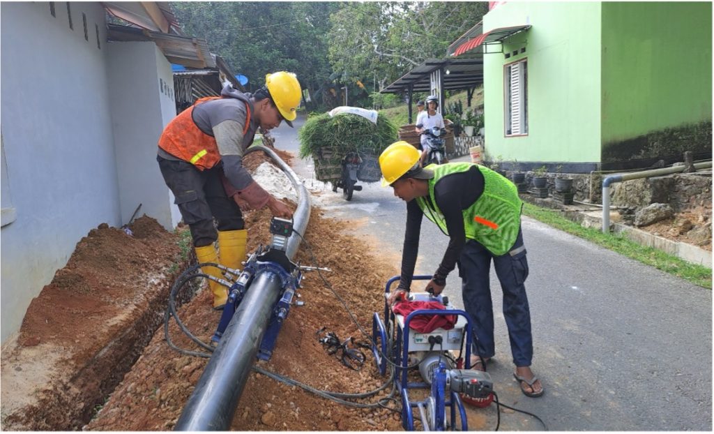
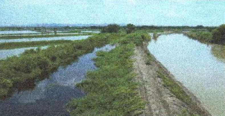
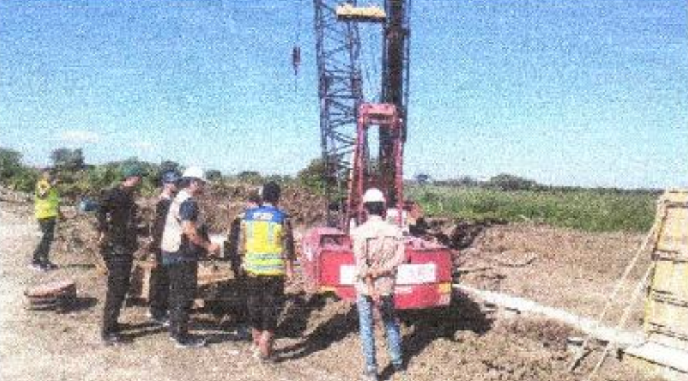
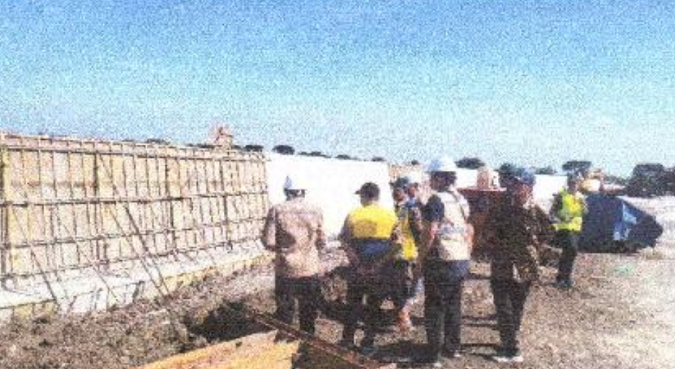
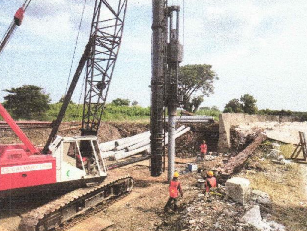
This project focuses on the supervision of intake infrastructure and raw water transmission pipeline construction in Kampung Merancang, East Kalimantan. The initiative aims to strengthen water supply reliability to meet the growing demand for clean water in residential, industrial, and public service sectors.
The Supervision Consultant ensures that construction activities are carried out according to technical standards, contractual requirements, and environmental regulations, while also maintaining close coordination with stakeholders and local communities.
🔸 Scope of Work
Supervision of intake construction at the designated raw water source.
Monitoring the installation of transmission pipelines for raw water distribution.
Ensuring compliance with design drawings, technical specifications, and safety standards.
Conducting quality control and verification of construction materials and methods.
Supporting project management activities, including schedule, budget, and risk control.
🔸 Key Benefits
Improved water security for Kampung Merancang and surrounding areas.
Enhanced public health through access to reliable and safe raw water supply.
Support for regional development, ensuring sufficient water resources for future needs.
Environmental sustainability by integrating eco-friendly construction and operational practices.
This project represents a crucial step in sustainable water resource management in East Kalimantan, providing long-term socio-economic benefits to the community.
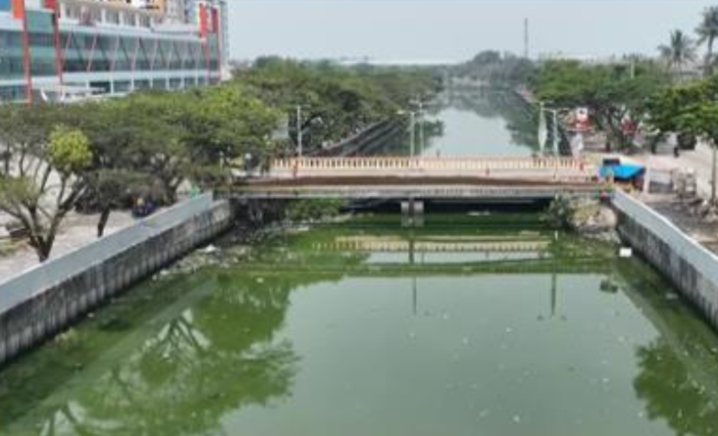
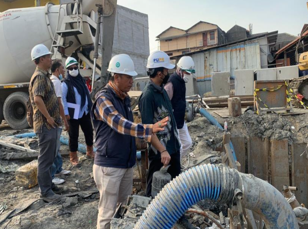
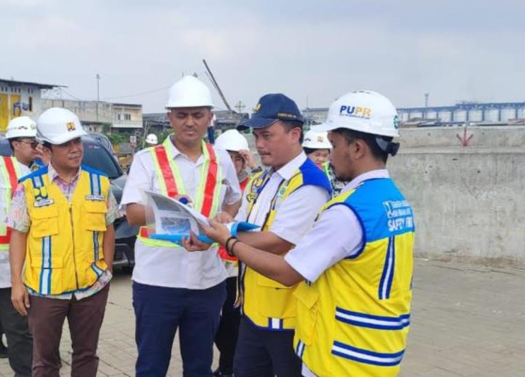
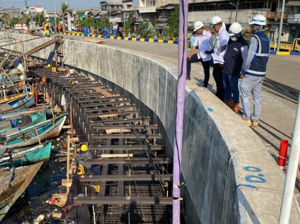
As part of the Jakarta Bay Coastal Defense program, this project focuses on the construction of a comprehensive coastal protection system in Phase VI, Package 6, which covers critical shoreline segments vulnerable to tidal flooding and abrasion. The initiative aims to strengthen Jakarta’s resilience against climate change impacts, rising sea levels, and severe tidal surges.
The Supervision Consultant ensures that construction activities comply with technical specifications, environmental standards, and safety protocols, while also monitoring quality control and coordinating with multiple stakeholders due to the strategic location of the project.
🔸 Scope of Work
Supervision of coastal protection structures including seawalls, revetments, and complementary facilities.
Monitoring construction quality, material standards, and durability against high wave forces.
Overseeing compliance with design requirements, construction schedules, and safety procedures.
Conducting technical reviews and adjustments to optimize the protection system.
Facilitating coordination with local authorities and communities to ensure smooth project execution.
🔸 Key Benefits
Flood protection for Jakarta’s coastal communities and critical infrastructures.
Climate resilience by mitigating the risks of sea level rise and storm surges.
Urban sustainability through strengthened coastal defense infrastructure.
Community safety and socio-economic stability in one of Indonesia’s most densely populated regions.
This project reflects the government’s long-term vision to secure Jakarta’s shoreline and protect millions of residents from the increasing threats of coastal hazards.
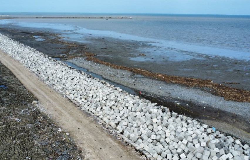
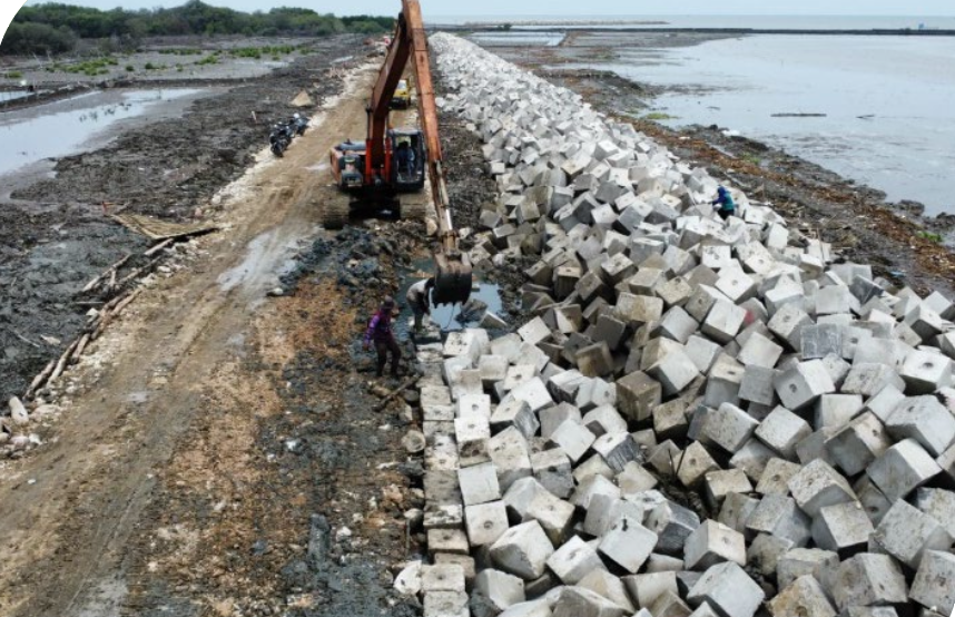
Located along the northern coast of Cirebon Regency, West Java, Kapetakan District is highly vulnerable to coastal abrasion and tidal flooding. To address this urgent challenge, the government initiated the construction of a coastal revetment as a protective structure to safeguard settlements, public facilities, and productive land in the area.
The Supervision Consultant played a key role in ensuring that the revetment construction adhered to design specifications, quality standards, and safety protocols, while also coordinating with local stakeholders to minimize disruptions during project execution.
🔸 Scope of Work
Supervising revetment construction activities including stone masonry, slope protection, and shoreline stabilization.
Monitoring the quality and durability of construction materials to withstand wave forces and coastal dynamics.
Ensuring compliance with technical designs, safety standards, and construction schedules.
Coordinating with local communities regarding land use, access, and project impacts.
Providing technical recommendations to optimize the effectiveness of coastal protection measures.
🔸 Key Benefits
Coastal protection → preventing erosion and safeguarding local communities and assets.
Disaster risk reduction → mitigating the impacts of tidal flooding and storm surges.
Sustainable shoreline management → maintaining the balance between infrastructure and the natural environment.
Community resilience → supporting socio-economic activities in coastal areas by ensuring safety and security.
This project highlights the government’s commitment to strengthening coastal infrastructure and protecting vulnerable communities in Cirebon’s northern coastal region.
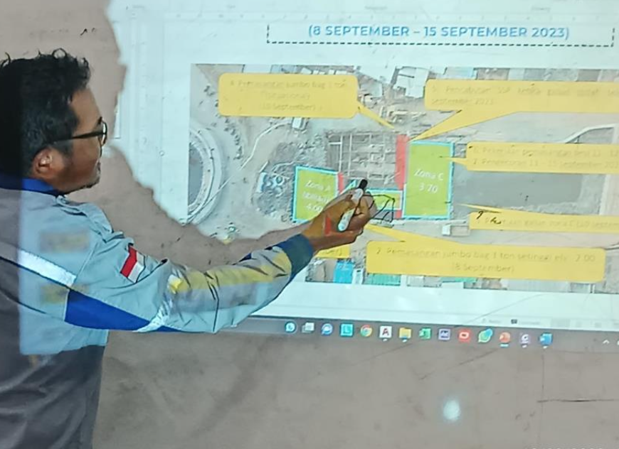
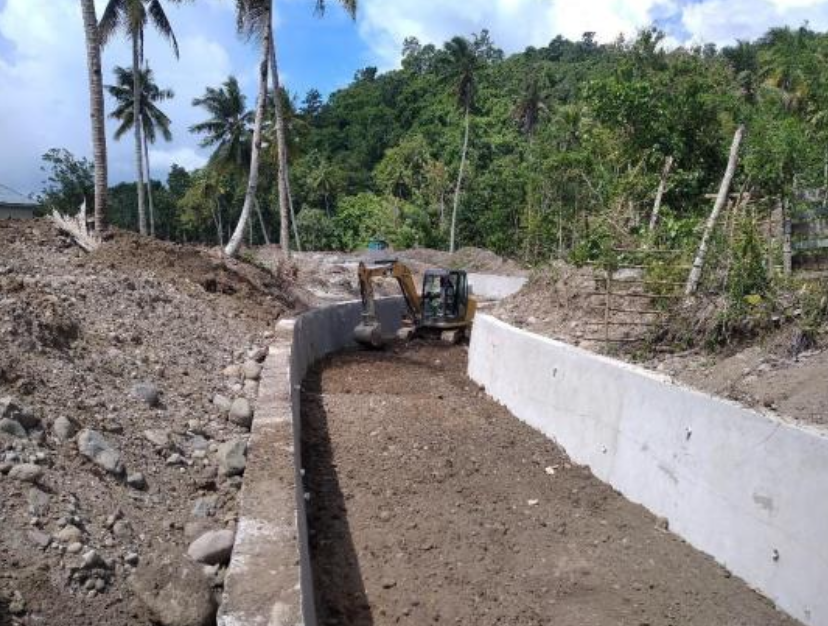
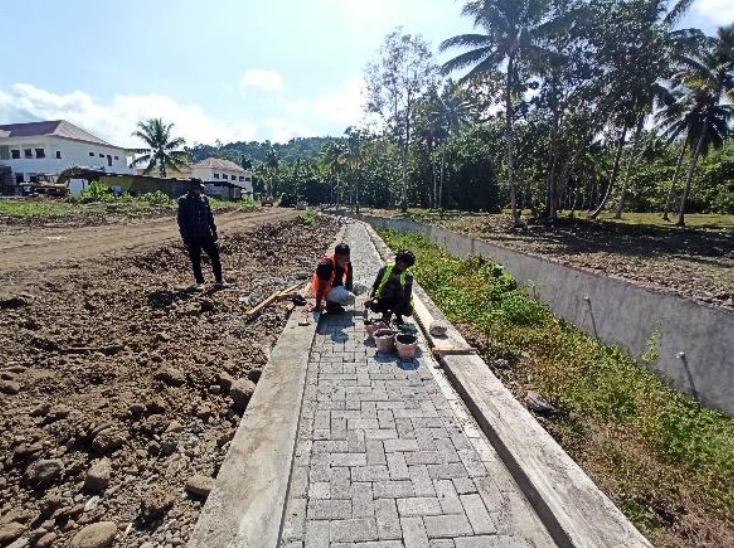
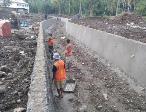
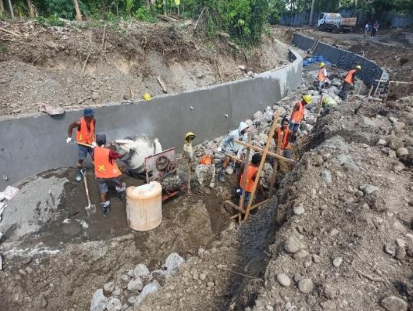
The development of Sofifi New City in North Maluku requires reliable urban drainage infrastructure to support its role as a growing administrative and economic hub. To address this need, the government initiated the construction of the Primary Drainage System, with supervision services ensuring that works are executed effectively and in compliance with technical standards.
The supervision consultant oversaw construction planning, quality assurance, and stakeholder coordination to ensure that the drainage network is capable of mitigating flood risks, maintaining urban functionality, and supporting the long-term vision for Sofifi as a modern, resilient city.
🔸 Scope of Work
Supervising the implementation of primary drainage construction, ensuring adherence to technical specifications and design.
Monitoring the quality of construction materials and methods to guarantee durability and effectiveness.
Coordinating with local authorities and communities regarding land use, traffic flow, and environmental considerations.
Reviewing and approving contractor work plans, schedules, and reporting.
Providing recommendations for improved drainage performance and future urban development integration.
🔸 Key Benefits
Flood mitigation → reducing the risk of inundation in residential and urban areas.
Urban resilience → strengthening Sofifi’s infrastructure to support rapid city development.
Sustainability → ensuring proper operation and long-term maintenance of drainage facilities.
Community well-being → enhancing safety, comfort, and livability for residents.
This project contributes significantly to shaping Sofifi New City into a modern, well-planned, and sustainable urban center in North Maluku.
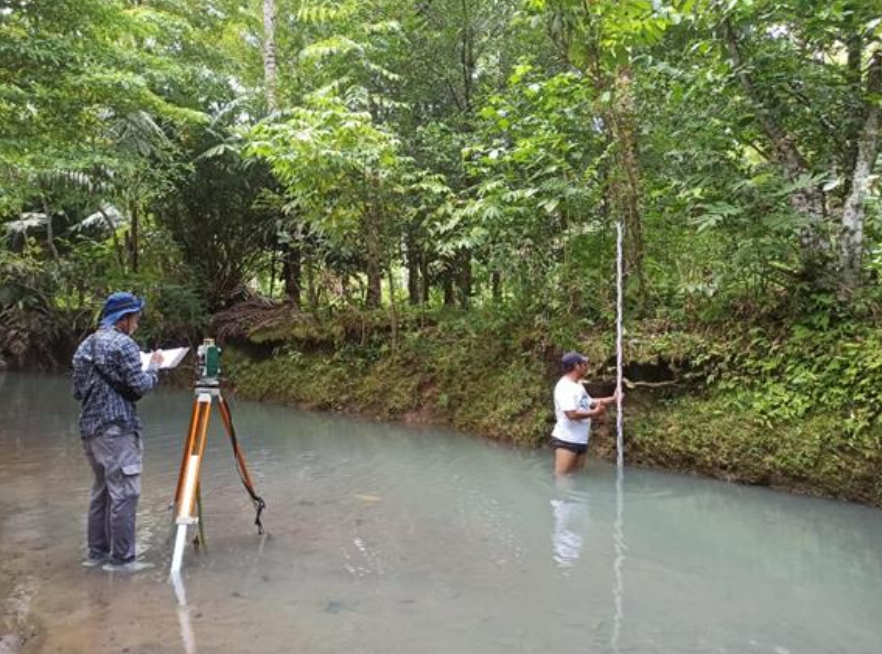
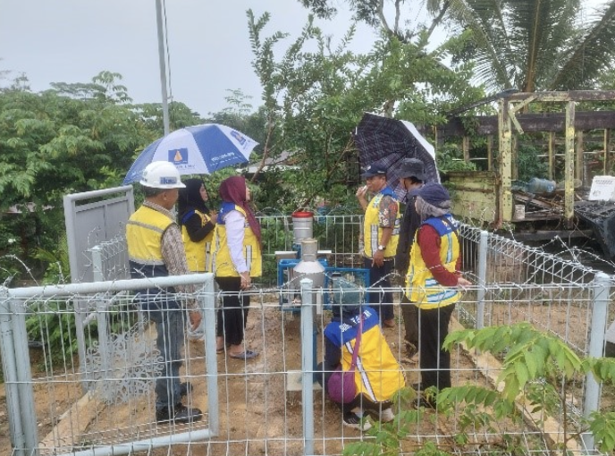
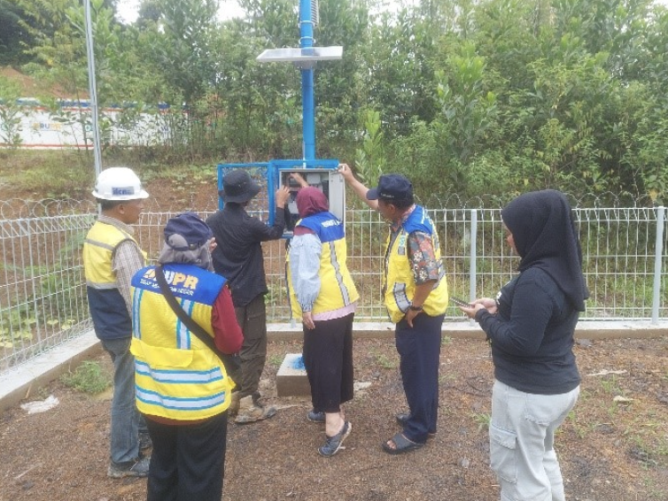
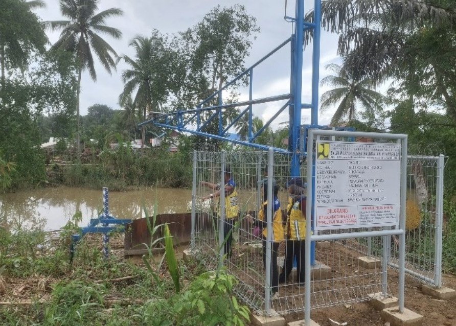
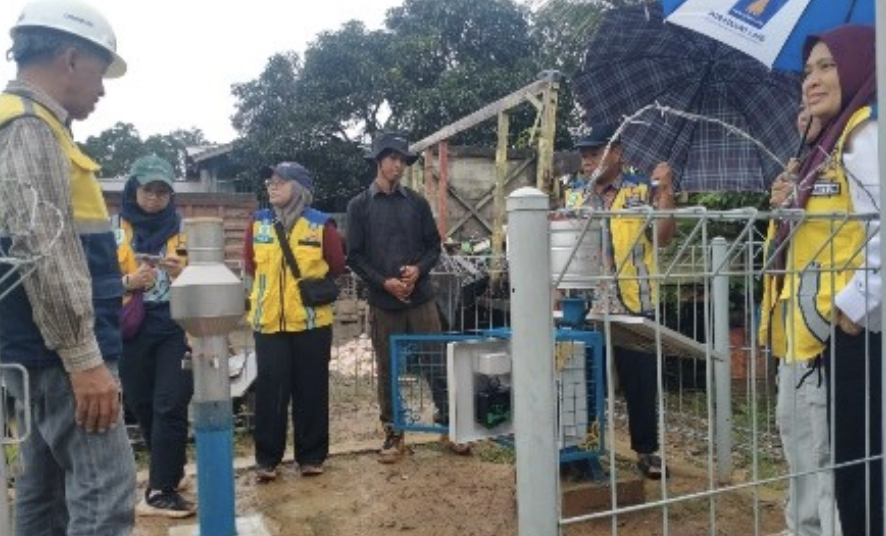
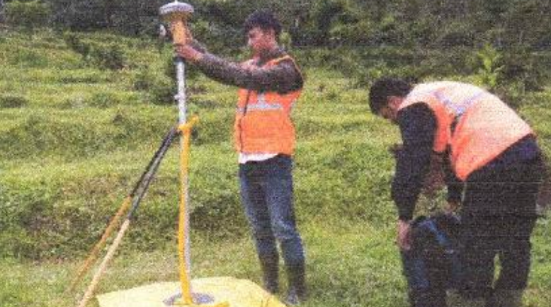
The Sanggai Watershed (DAS Sanggai), located in the Core Government Area (KIPP) of the new capital city (IKN Nusantara), plays a crucial role in flood risk management and water security. To enhance disaster preparedness, an Early Warning System (EWS) project was launched, supported by a supervision consultant to ensure effective and reliable implementation.
The Supervision Consultant was responsible for monitoring all aspects of EWS development, from the installation of hydrological and meteorological equipment to integration with monitoring and communication systems. This ensures the system is functional, sustainable, and capable of providing real-time information to protect communities and critical infrastructure in IKN.
🔸 Scope of Work
Supervising installation of hydrological and meteorological monitoring instruments.
Overseeing the development of real-time data transmission and alert systems.
Ensuring compliance with technical standards, safety, and environmental safeguards.
Reviewing technical adjustments and providing recommendations for system optimization.
Coordinating with government agencies, contractors, and local communities.
Preparing supervision reports and technical evaluations.
🔸 Key Benefits
Flood risk reduction → providing timely alerts to safeguard communities and infrastructure in IKN.
Data-driven decision making → enabling government agencies to manage water resources and emergencies more effectively.
Resilient infrastructure support → strengthening disaster preparedness in Indonesia’s new capital city.
Community protection → ensuring early action against potential natural disasters in high-priority areas.
This project contributes to the establishment of a resilient and sustainable capital city, where modern technology and supervision practices ensure reliable flood early warning systems for long-term safety.
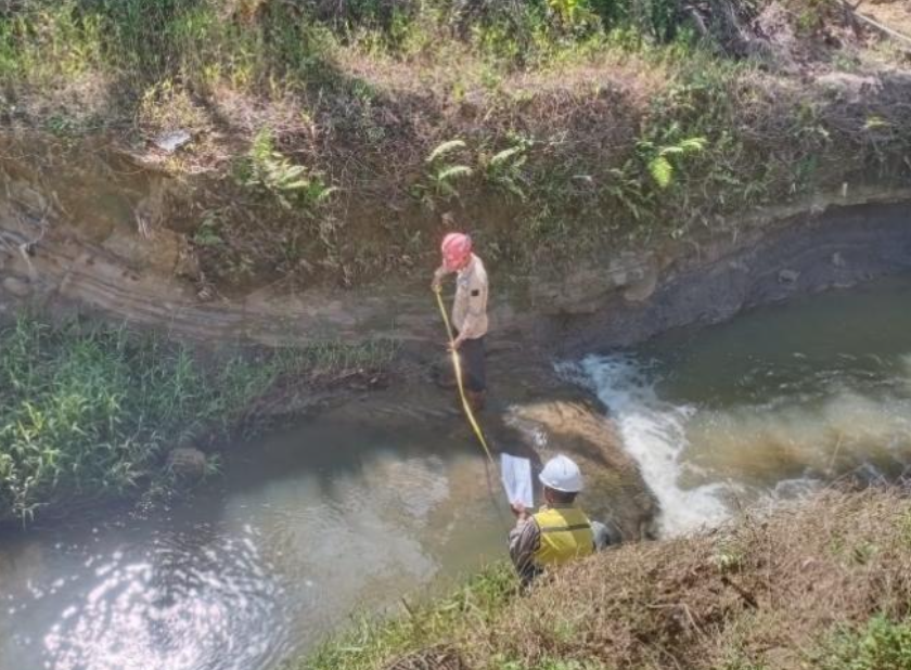
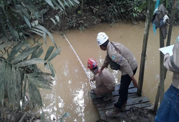
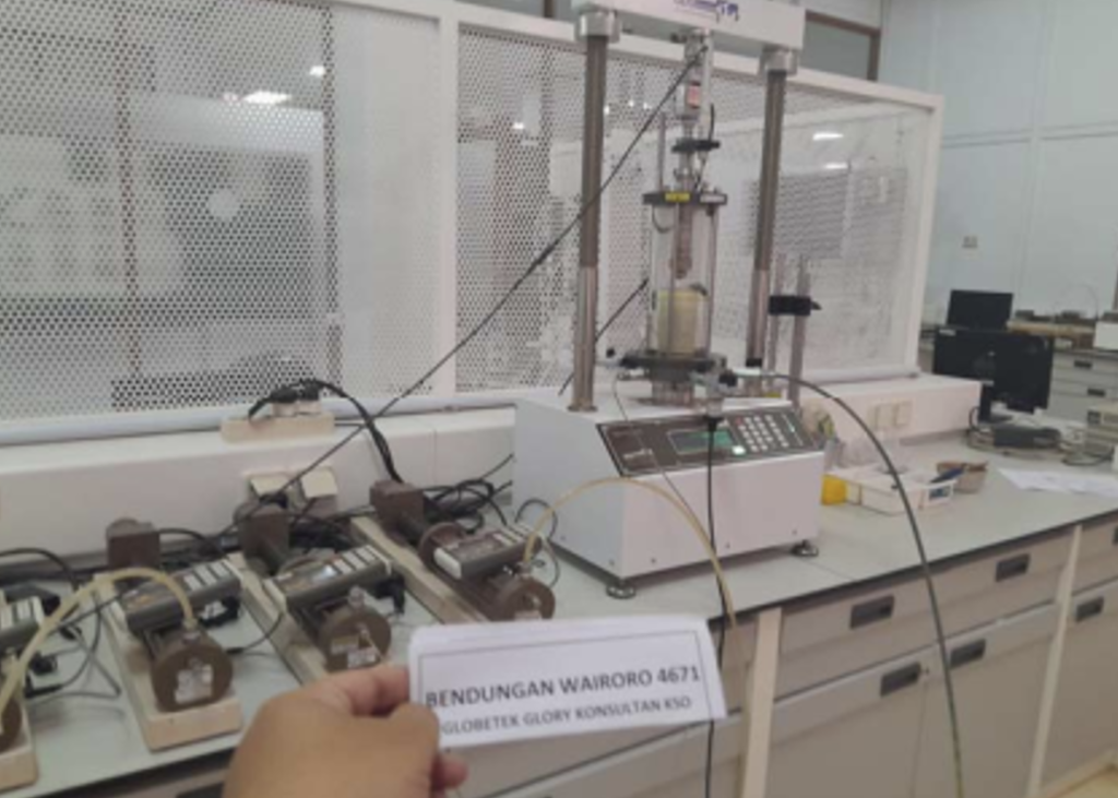
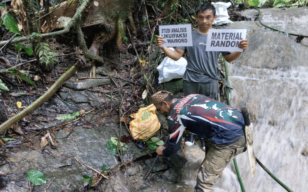
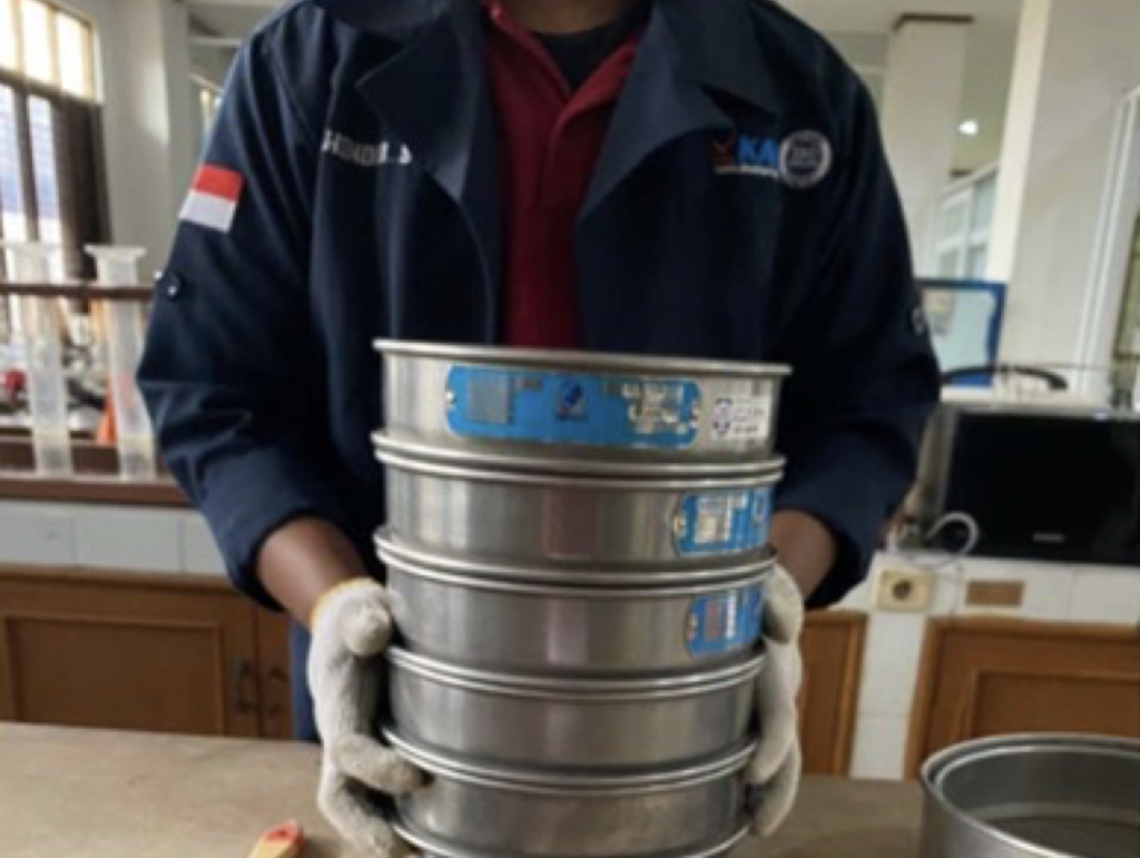
The Wairoro Dam Project is a strategic infrastructure initiative aimed at strengthening water resource management, irrigation, and flood control in Central Halmahera Regency, North Maluku. Considering the dam’s geological conditions, a Liquefaction Analysis Study was conducted to evaluate soil behavior under seismic loading and to ensure the structural safety of the dam.
The study focused on identifying zones susceptible to liquefaction, analyzing soil strength, and providing technical recommendations for dam foundation design and mitigation strategies. This ensures that the Wairoro Dam can be constructed with resilience against seismic risks and long-term operational reliability.
🔸 Scope of Work
Conducting geological and geotechnical investigations in the dam site area.
Performing seismic hazard and soil liquefaction potential analysis.
Evaluating soil shear strength and dynamic response under earthquake scenarios.
Recommending ground improvement and mitigation measures to reduce liquefaction risk.
Integrating study results into safe and sustainable dam design parameters.
Risk mitigation → reducing the likelihood of soil failure and dam instability.
Scientific foundation for design → providing reliable data for engineering decisions.
Sustainable water infrastructure → securing long-term benefits of irrigation, water supply, and flood protection for local communities.
This study forms a critical foundation for the safe construction and operation of Wairoro Dam, aligning engineering best practices with disaster risk reduction strategies in seismically active regions.
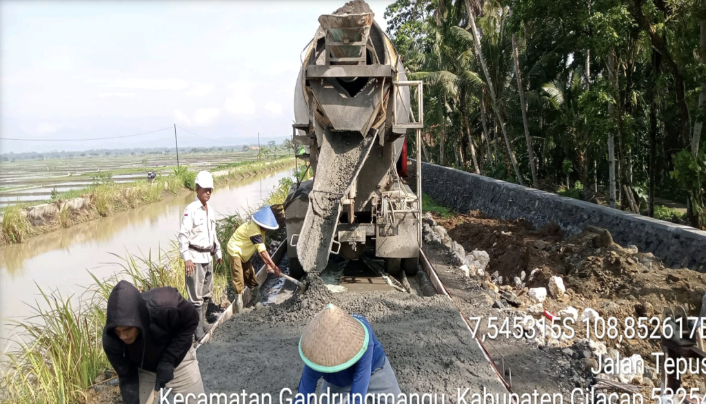
The Manganti Irrigation Area (Daerah Irigasi Manganti), supplied by the Cihaur River, is one of the key irrigation systems supporting agricultural productivity in Ciamis Regency, West Java. Over the years, degradation of irrigation channels and supporting structures has reduced water distribution efficiency, threatening the stability of rice production and local farmers’ livelihoods.
To address this, a Phase III Rehabilitation Project was launched, with the Supervision Consultant ensuring quality implementation, compliance with technical specifications, and integration with long-term irrigation management strategies.
🔸 Scope of Work
Supervising construction and rehabilitation of primary and secondary irrigation networks.
Monitoring material quality, construction methods, and compliance with design standards.
Reviewing technical drawings and providing recommendations for modifications as needed.
Ensuring implementation of occupational health, safety, and environmental (HSE) practices.
Coordinating with contractors, government agencies, and local communities to minimize disruptions.
Preparing periodic reports on progress, challenges, and solutions.
🔸 Key Benefits
Improved water distribution efficiency → ensuring reliable irrigation across farmlands.
Increased agricultural productivity → supporting food security and farmer resilience in Ciamis.
Restored infrastructure performance → prolonging the life of the irrigation network.
Community empowerment → involving local stakeholders in sustainable irrigation management.
The project strengthens the role of D.I. Manganti (Cihaur) as a vital agricultural backbone, contributing to regional food security and sustainable water resources management in West Java.
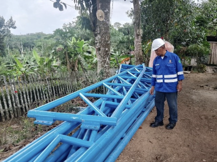
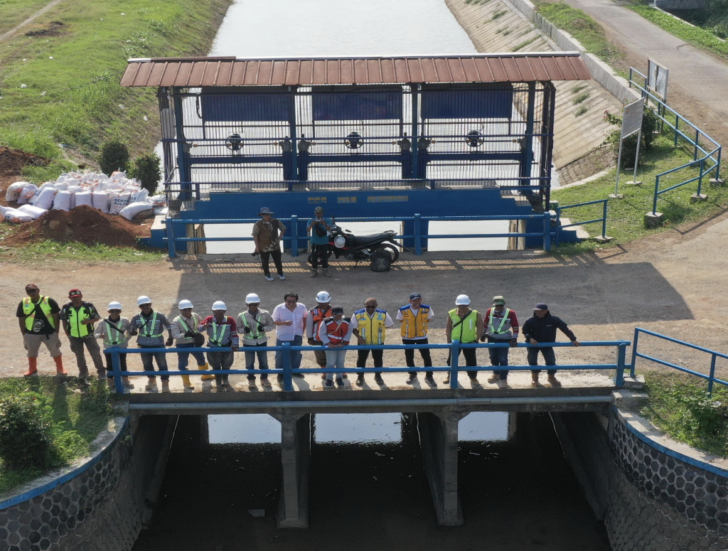
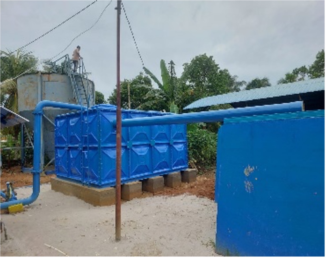
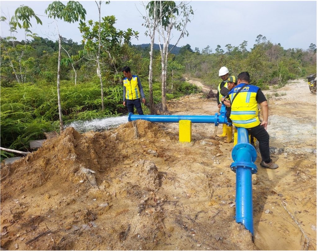
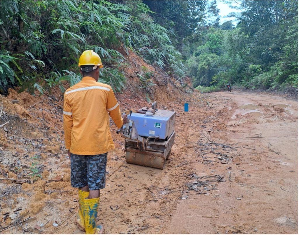
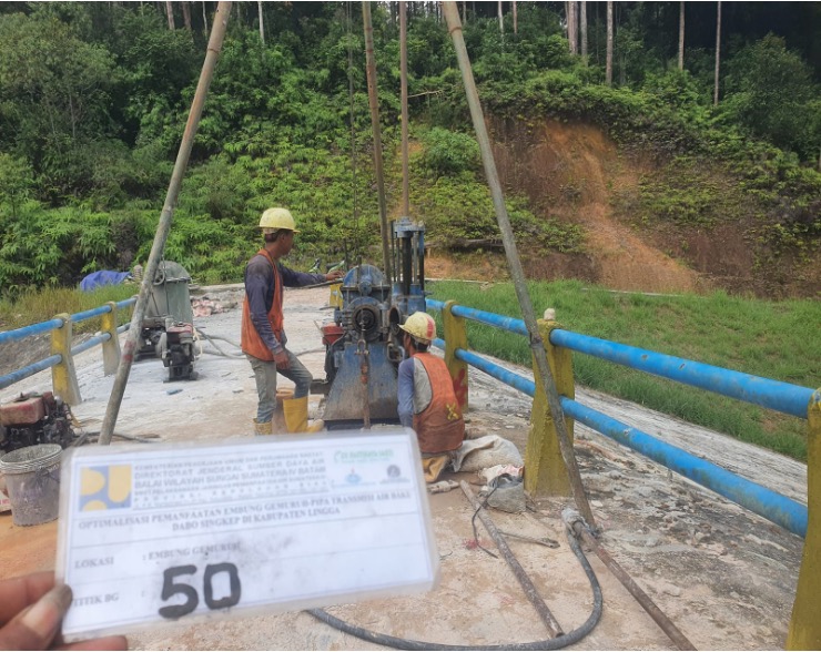
The Gemuruh Reservoir and its transmission pipeline system are vital infrastructures for meeting the raw water needs of Dabo Singkep City and surrounding areas in Lingga Regency. To ensure reliable supply and optimize operations, a supervision project was initiated focusing on both reservoir utilization and the construction of the raw water transmission pipeline.
The Supervision Consultant was appointed to oversee the implementation, ensuring construction and operational works were aligned with technical standards, environmental safeguards, and community needs. The consultant also provided critical inputs to enhance efficiency and sustainability of the water supply system.
🔸 Scope of Work
Supervising construction and installation of raw water transmission pipelines.
Monitoring civil works at the Gemuruh Reservoir, ensuring compliance with design and quality standards.
Reviewing design adjustments and providing technical recommendations for optimization.
Ensuring implementation of health, safety, and environmental (HSE) procedures.
Coordinating with contractors, local government, and stakeholders for smooth execution.
Preparing regular progress and technical evaluation reports.
🔸 Key Benefits
Reliable raw water supply → strengthening water availability for households, businesses, and public facilities in Dabo Singkep.
Optimized reservoir utilization → ensuring sustainable management of existing water resources.
Improved infrastructure efficiency → through enhanced design review and construction supervision.
Community resilience → reducing risks of water scarcity and supporting socio-economic development in Lingga Regency.
This project demonstrates the government’s commitment to sustainable water infrastructure development, ensuring that the Gemuruh Reservoir and transmission pipelines operate effectively to meet growing demand in the Riau Islands.
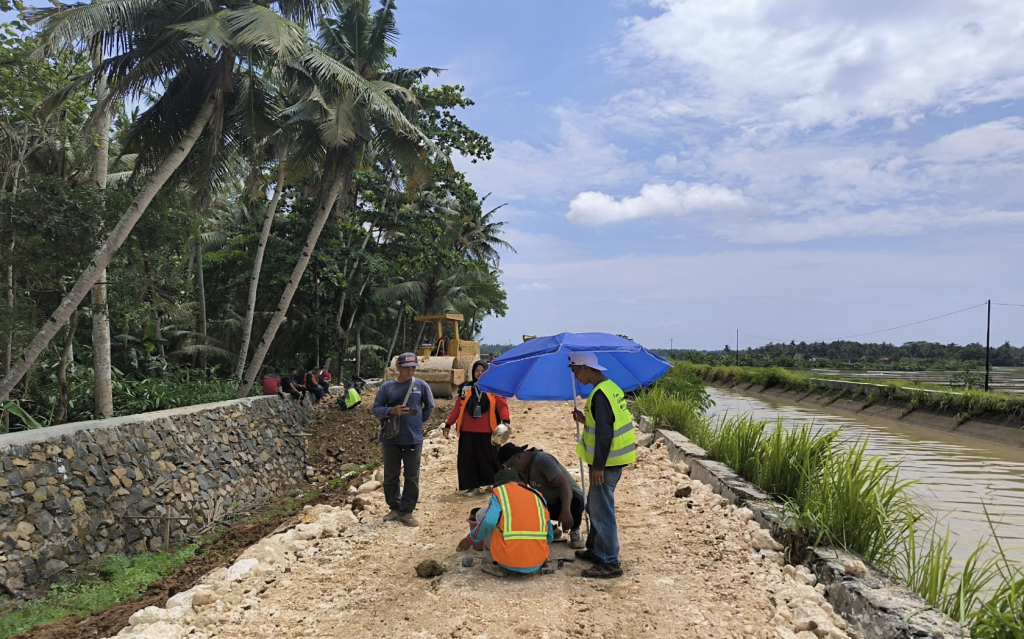
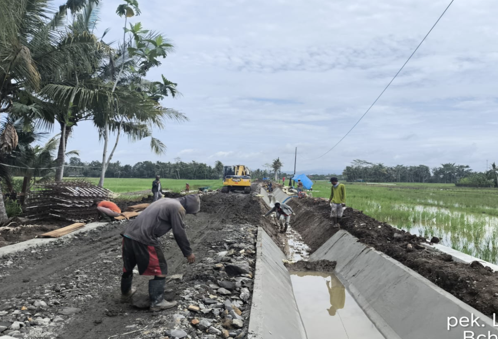
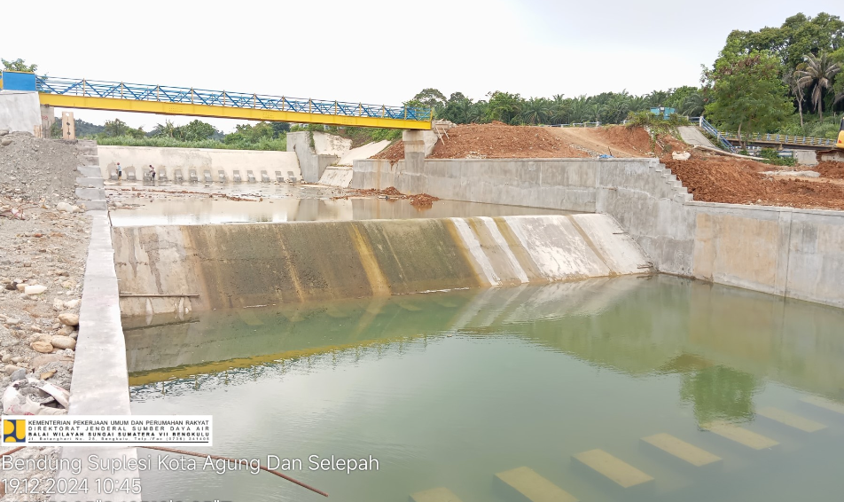
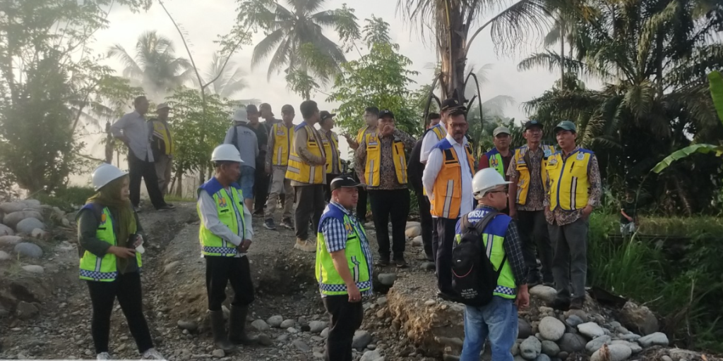
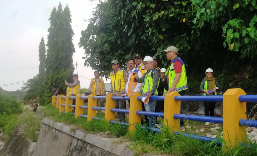
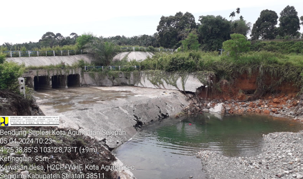
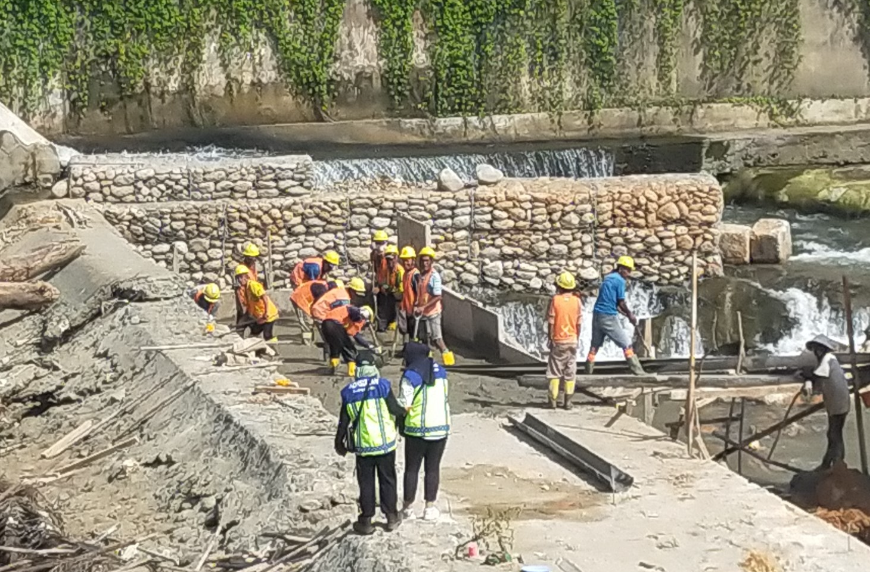
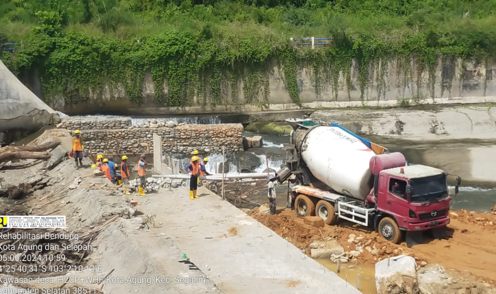
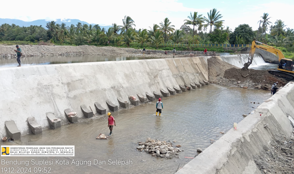
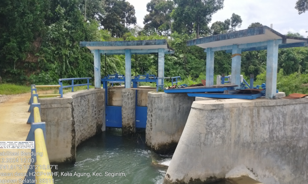
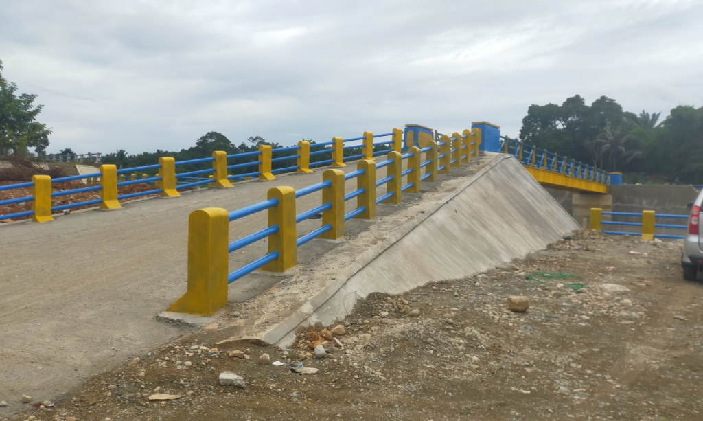
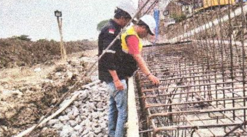
The Kota Agung and Selepah Diversion Weirs play a crucial role in supporting irrigation networks and agricultural productivity across South Bengkulu Regency. Over time, structural deterioration and sedimentation reduced their performance, threatening water distribution reliability and local farming activities. The rehabilitation project was therefore initiated to restore, strengthen, and modernize these critical infrastructures.
The Supervision Consultant was appointed to ensure that all rehabilitation works were carried out effectively, safely, and in accordance with technical and contractual standards. Through continuous monitoring, the consultant facilitated smooth project delivery, improved construction quality, and minimized risks to communities and the environment.
🔸 Scope of Work
Monitoring construction progress, workmanship, and compliance with technical specifications.
Reviewing design modifications and providing technical recommendations when required.
Supervising material quality, safety procedures, and environmental safeguards.
Coordinating with contractors, stakeholders, and local institutions to resolve field challenges.
Preparing progress reports, identifying risks, and recommending corrective actions.
🔸 Key Benefits
Enhanced irrigation reliability → ensuring stable water distribution for thousands of hectares of farmland.
Strengthened agricultural productivity → securing livelihoods of local farming communities.
Sustainable water resources management → supporting food security and long-term resilience.
Improved infrastructure safety → minimizing risks of structural failure and environmental damage.
This project not only restores the functionality of the diversion weirs but also creates long-term socio-economic impacts, reinforcing the foundation for sustainable agricultural growth in South Bengkulu Regency.
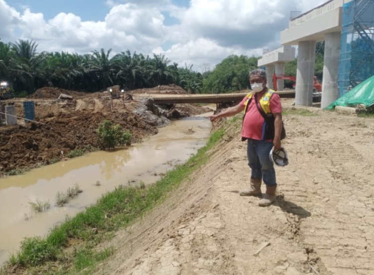
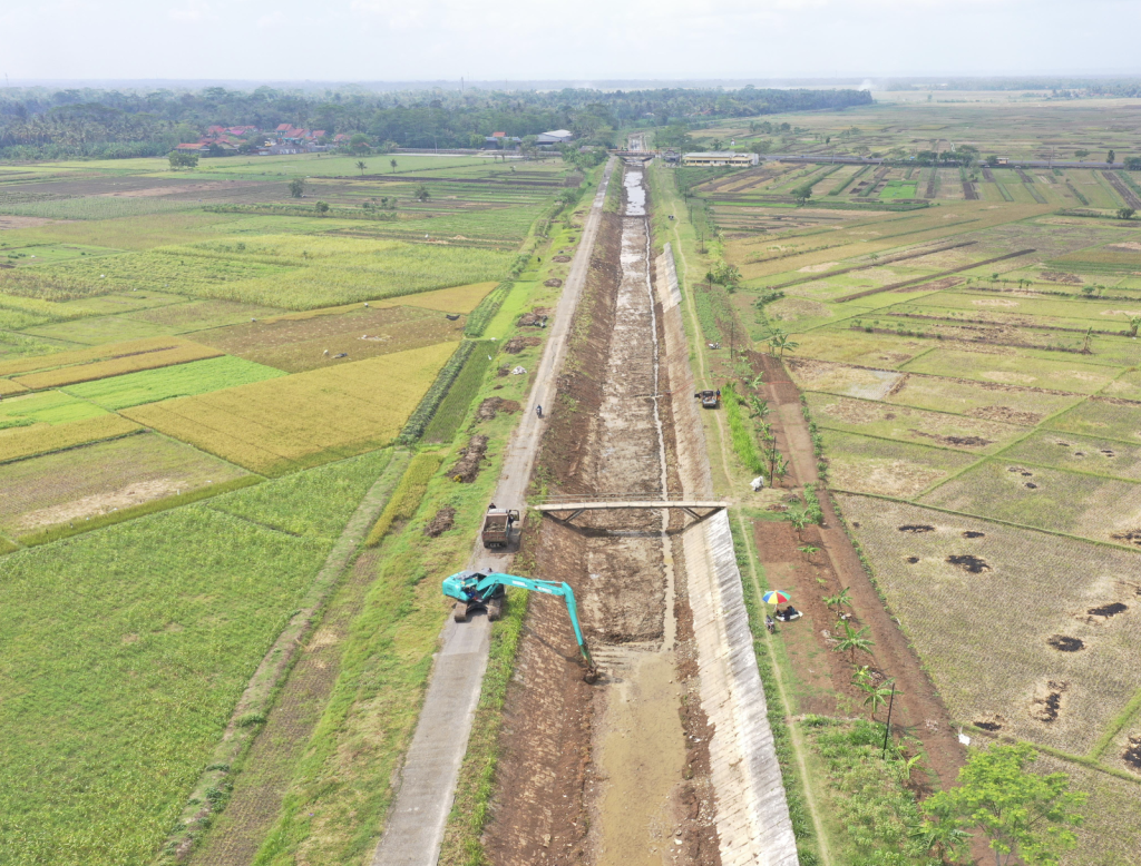
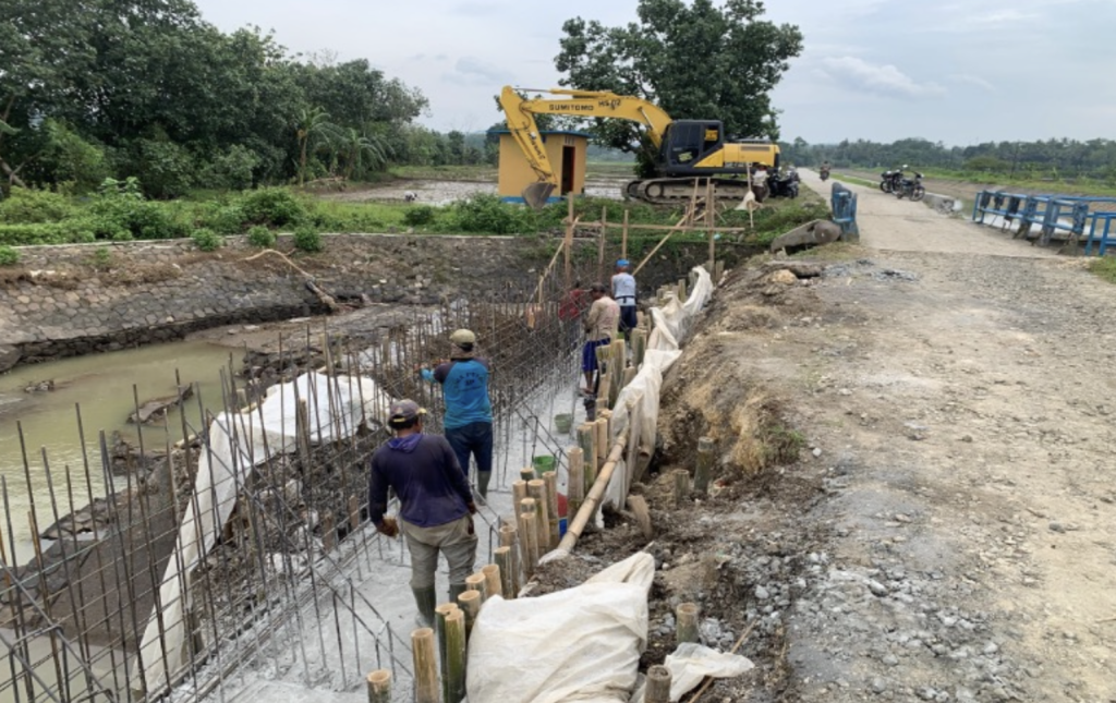
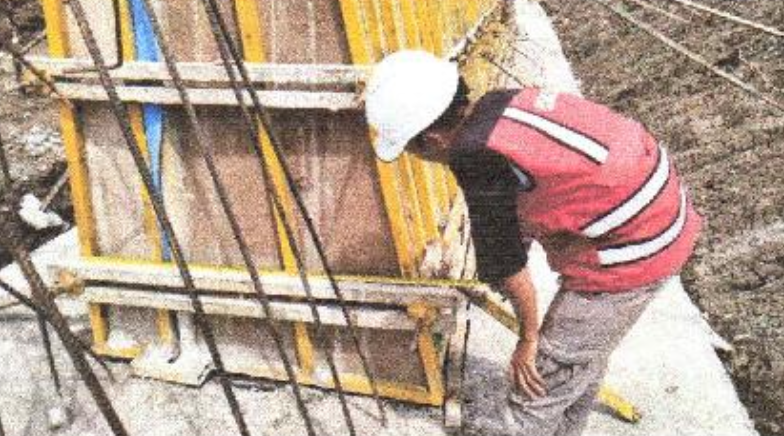
The Lamong River Basin, part of the Bengawan Solo Watershed, has long been prone to recurring floods that severely affect communities across Gresik and surrounding areas. To mitigate these impacts, the Ministry of Public Works and Public Housing (PUPR) through BBWS Bengawan Solo initiated a Flood Control Construction Project, with a dedicated supervision consultant ensuring quality and compliance throughout implementation.
The project includes the construction of riverbank protection structures such as concrete parapet walls, sheet piles, and supporting infrastructure designed to enhance resilience against flooding. The Supervision Consultant plays a vital role in monitoring technical works, ensuring safety compliance, and providing professional recommendations for optimized results.
🔸 Scope of Work
Supervising construction activities for flood control structures.
Reviewing and validating design adjustments to suit field conditions.
Monitoring material quality, structural integrity, and construction schedule.
Ensuring compliance with safety standards (K3) and environmental safeguards.
Coordinating with stakeholders including BBWS Bengawan Solo, contractors, and local communities.
Preparing technical reports, evaluations, and as-built documentation.
🔸 Key Benefits
Flood risk reduction → minimizing community and infrastructure losses in Gresik Regency.
Improved resilience → strengthening riverbank capacity against future hydrological events.
Efficient project delivery → ensuring work is completed on time and in line with technical standards.
Sustainable infrastructure → contributing to long-term water resources management in the Bengawan Solo Watershed.
This project strengthens flood resilience in Gresik Regency, East Java, serving as a crucial step in safeguarding communities along the Lamong River.